Sinoptička situacija - s područja Alpa pristizala je manja količna vlažnijeg zraka, posljepodne lokalno jači razvoj naoblake uz pljuskove i grmljavinu, mjestimice je bilo i tuče.
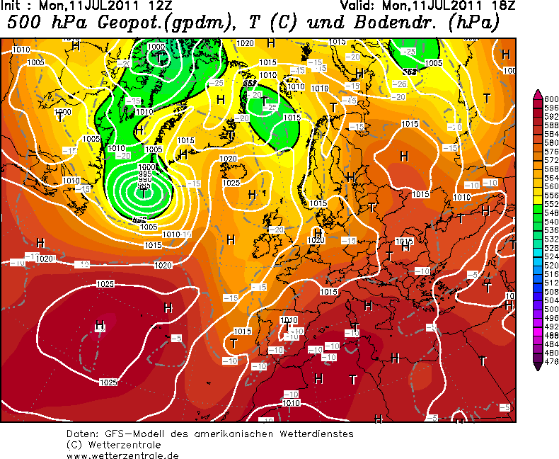
Hladni zrak iz zapadne Evrope potiskuje prema istoku uzrokujući nestabilnosti:

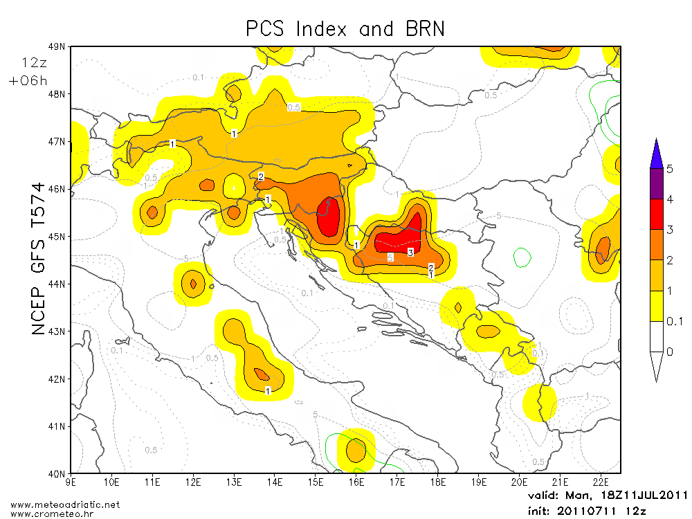
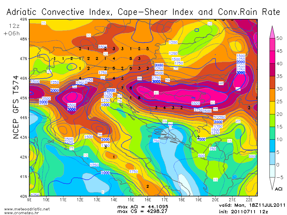
Iako je cape bio izrazito visok nisu se uspijele organizirati jače oluje zbog slabog smicanja vjetra.

Storm Forecast
Valid: Mon 11 Jul 2011 06:00 to Tue 12 Jul 2011 06:00 UTC
Issued: Sun 10 Jul 2011 23:07
Forecaster: TUSCHY
A level 1 was issued for far Croatia, Hungary, parts of Slovakia, SE-Poland and the W-Ukraine mainly for large hail to a few significant hail reports and severe to damaging wind gusts.A level 1 was issued for most parts of E-CNTRL Europe mainly for large hail and severe wind gusts.
A level 1 was issued for Estonia, Latvia and Lithuania mainly for excessive rainfall and an isolated large hail event.
A level 1 was issued for N-Sweden and Norway mainly for an isolated large hail event.
A level 1 was issued for parts of Spain, the Bay of Biscay and W-France mainly for large hail. Significant hail is forecast over central/east Spain.
SYNOPSIS
A quasi-stationary cyclonic vortex over N-Europe steers numerous disturbances to the east/northeast. Also, a sharp upper trough evolves just west of Europe and approaches the Iberian Peninsula during the night hours from the northwest. This pattern allows widespread thunderstorm development over most parts of Europe.
DISCUSSION
... E-Croatia, Hungary, Slovakia, W-Ukraine and SE-Poland ...
The combination of modest shear and abundant CAPE creates a set-up favorable for well organized convection. A concentrated outbreak of severe thunderstorms is forecast.
Focus for initiation will be a northeastward sliding upper trough and a eastward moving cold front. Betimes, the boundary outruns favorable upper support which causes a slow-down over the highlighted area. Nevertheless, a continued SE-ward movement is forecast as postfront high pressure builds in from the west, assisting in a modest NW-erly gradient flow. Initiation heavily depends on that boundary, but also on local topography and mesoscale boundaries from convection the day before.
ECMWF and GFS agree in the release of abundant MLCAPE/SBCAPE in the order of 1500 - 2500 J/kg with ICAPE exceeding 3000 kJ/m^2 as dry/mixed mid-layer air mass (EML) overspreads a moist lower troposphere (925 hPa dewpoints at or above 15°C and high mean surface mixing ratio). Models still disagree where most robust CAPE will be with GFS highlighting Hungary and E-Croatia and ECMWF favoring areas more to the north/northeast. Latest indications are that both model forecasts seem reasonable depending only on different nuances in the surface pressure field.
Due to the weakening upper flow and decaying trough, the wind field at all levels is weak to modest with 0-6 km bulk shear in the range o 10-15 m/s. However, given abundant CAPE, this is adequate for well organized multicells.
Widespread initiation is forecast during the day. During initiation stage, the risk of large to significant hail is augmented next to severe/damaging downbursts (high delta theta-e forecasts with LCLs at or above 1000 m). As thunderstorms mature, numerous large clusters of thunderstorms are expected to move slowly to various directions (general E/NE movement with backbuilding to the S/SW possible). Internal maturing of clusters may pose a locally enhanced severe wind gusts risk with strong cold pool development next to large hail and locally excessive rainfall amounts. Thunderstorms will keep going all night long with an overall displacement to the east.... Central / E/NE Poland, Lithuania, Latvia and Estonia ...
Main uncertainty will be where the thunderstorm cluster from the night before (Germany) will be placed and how much cloud debris will inhibit insolation. However, models agree in rapid air mass destabilization ahead of an eastward moving cold front, so we expect an increase of thunderstorm activity over Poland already before noon. Eastward moving thunderstorms enter an air mass, which features high low-tropospheric moisture content and up to 1000 J/kg MLCAPE next to roughly 15 m/s DLS. Configuration of a neutral tilted upper trough (right entrance region affects highlighted region) and a persistent inflow from the S/SE favors widespread thunderstorm initiation and a large cluster of thunderstorm evolves over NE Poland, moving/building northeastwards. Large hail and strong wind gusts are expected with that activity but overall picture becomes very messy betimes as cluster matures. We think that Latvia, Lithuania and Estonia will see an augmented risk for excessive rainfall amounts with backbuilding thunderstorm clusters and persistent moisture feed from the south/southeast. Thunderstorms will keep going all night long while gradually decreasing over Poland from west to east.
... Norway and Sweden ...
A brisk SW-erly flow advects a moist air mass far to the north as the major upper trough draws near from the west. 15-20 m/s DLS overspread an air mass, which becomes moderately unstable with roughly 300 - 600 J/kg MLCAPE. Mainly daytime driven thunderstorms occur with the main risk being isolated large hail and strong wind gusts. A marginal level was introduced over the northern parts, where shear will be the strongest. Thunderstorms gradually decay during the night.
... Switzerland, Austria, N-Italy and Slovenia ...
The same story as in the past few days. Now a quasi-stationary boundary will be the focus for initiation next to the complex topography of the Alps. Scattered thunderstorms occur with large hail and strong to isolated severe wind gusts the primary risk. Expected thunderstorm coverage decreases during the night due to a combination of BL stabilization and deep WAA, as next system moves in over W-Europe with weak geopotential height increases.
... Portugal, Spain, Bay of Biscay and W-France ...
An active weather pattern is in store with an enhanced chance for organized thunderstorms over the highlighted area.
An upper trough approaches the Iberian Peninsula during the day and starts a rapid intensification process just to the NW. As a result, a 35 m/s 500 hPa jet evovles over Spain and Portugal which boosts 0-6 km shear to similar values during the evening and night hours. Also, an elongated surface depression gradually consolidates over the Iberian Peninsula and assists in a persistent moisture advection regime from the W-Mediterranean. The only inhibiting factor for initiation during the daytime hours will be ongoing WAA with 25 °C at 850 hPa, creating a stout cap. However during the evening hours and at the latest during the night, isolated thunderstorms probably develop over Spain...both along the sharpening cold front and along the coasts of N-Spain. Given forecast shear/instability overlap, significant hail events are possible with each thunderstorm over central /east Spain next to strong/severe downburst events. Further to the north, including N-Spain, the Bay of Biscay and SW/W-France, surface based initiation during the night seems less likely. Up to 800 J/kg MUCAPE and 20 m/s DLS still allow organized thunderstorm development with mainly an isolated large hail risk.
A level 1 was issued for that activity. However parts of central/east Spain may need an upgrade, if confidence increases in more robust thunderstorm coverage.
oko 16:00 h početak razvoja cb calvusa:


16:30 h

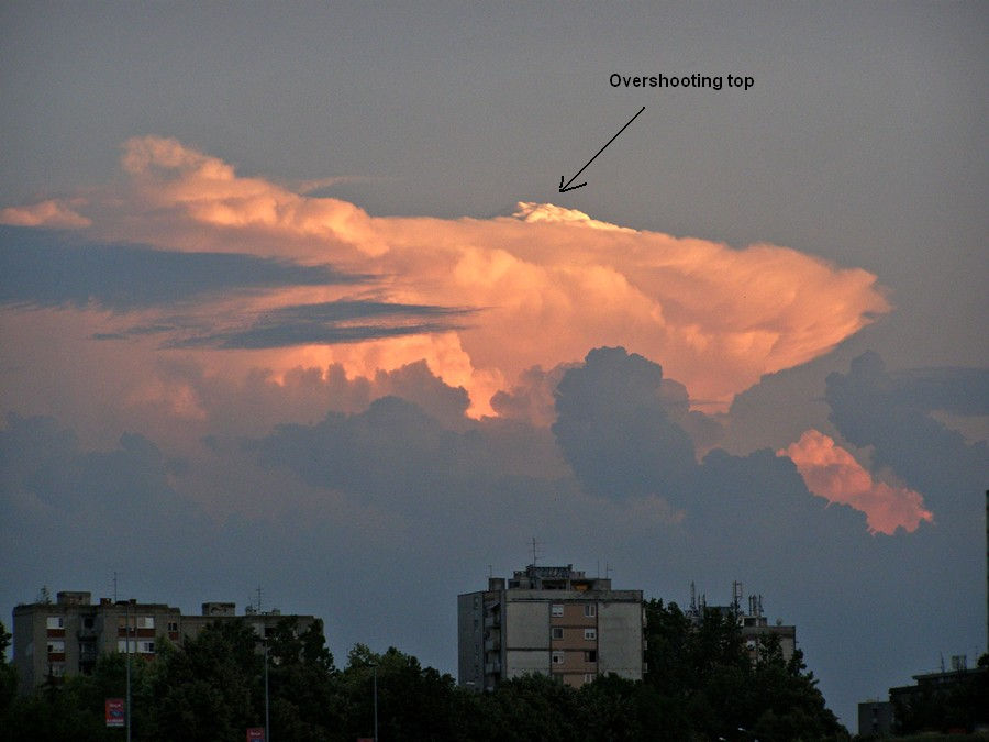
Početak razvoja LP Superćelije (LP-low preacipitation)

cb je sigurno imao dobru visinu, mnoštvo protuberanci (pupoljci)
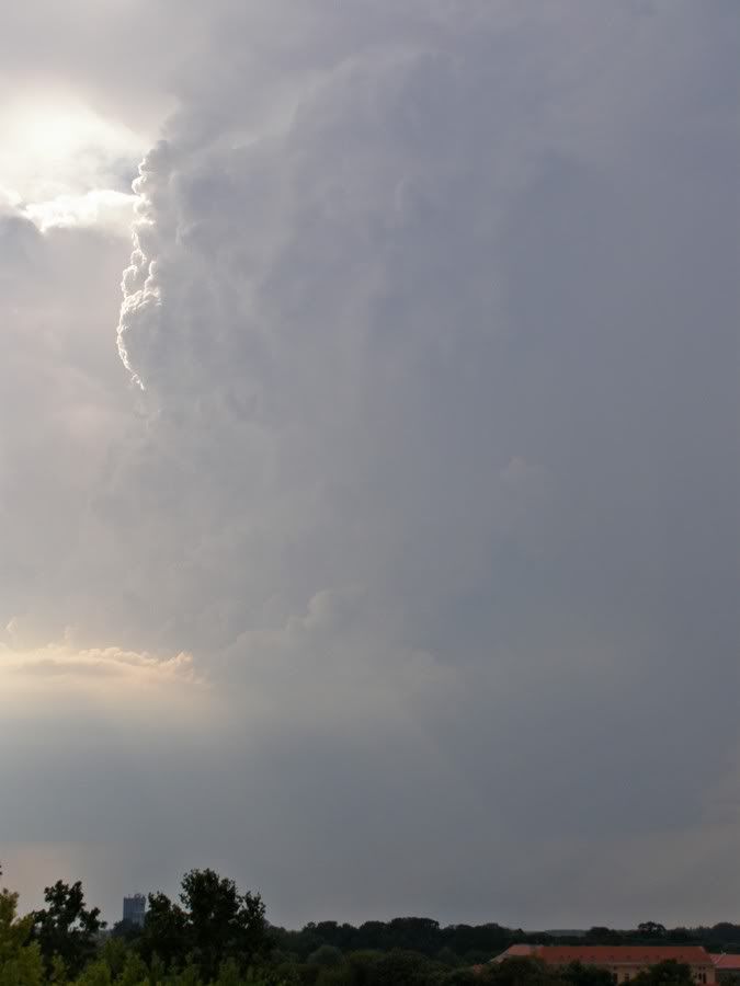
klasična LP superćelija:
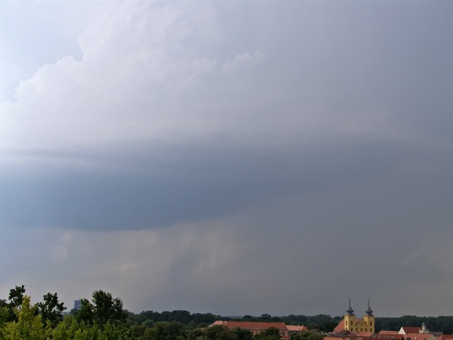
kako se približavao tako je sve više slabilo, bio je rijedak pljusak uz tuču veličine riže i graška
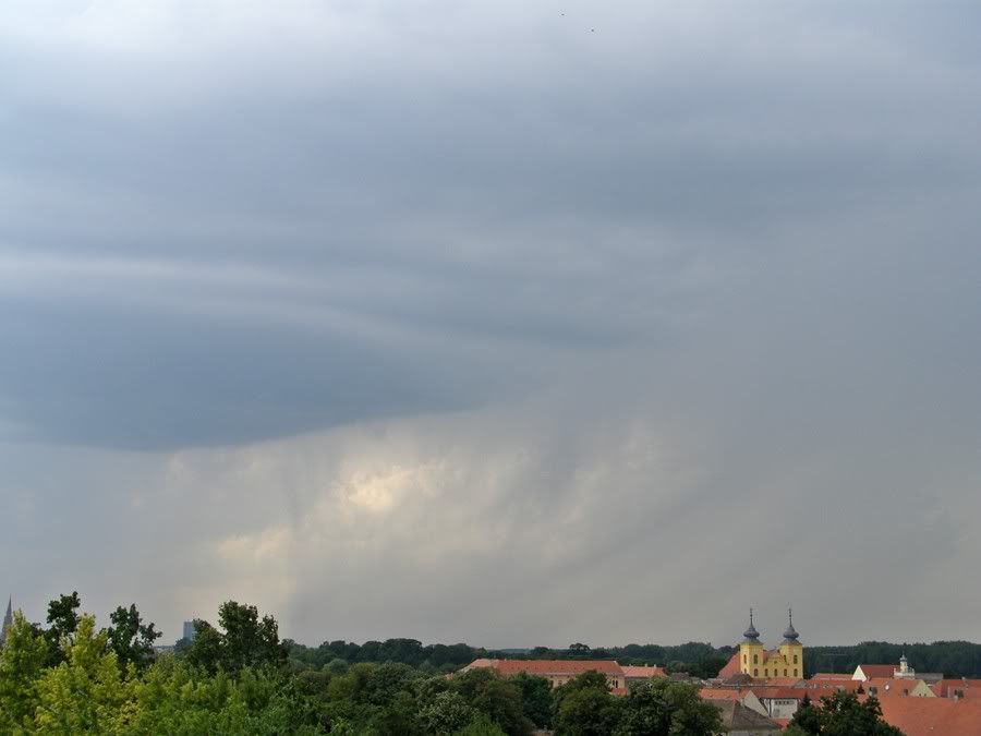
po radaru tuču smo dobili iz zelenog na radaru, pitanje je kako je bilo par km jugozapadnije ? (možda je bilo većih komada tuče ali i ne mora značiti). Da imam vertikalni presjek cb-a znali bi, ovako nagađamo.
radar u 17:30 h

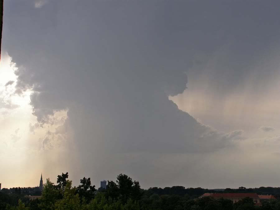
raspad cb-a
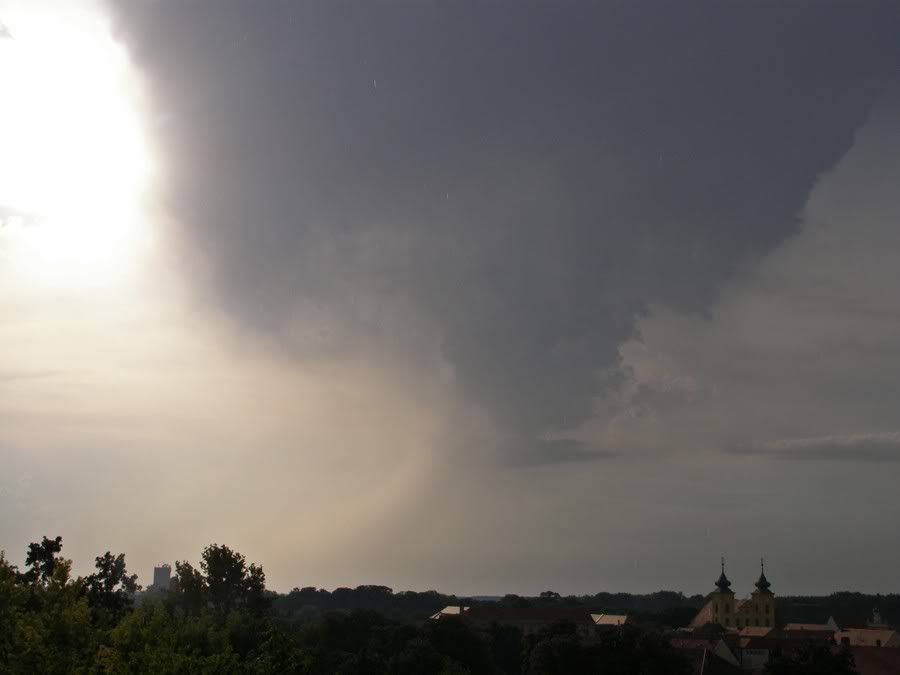
superćelija na jugu:

radar u 20:00 h

satelit:


Bilogora animacija:


