Ovo se moglo ocekivati.

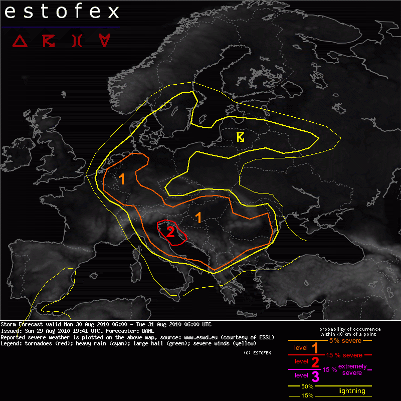
A level 1 was issued across the W Balkans mainly for excessive convective precipitation.
A level 1 was issued over Romania mainly for damaging winds and large hail.
... N Italy ... A Adriatic Sea ... western Balkan States ...
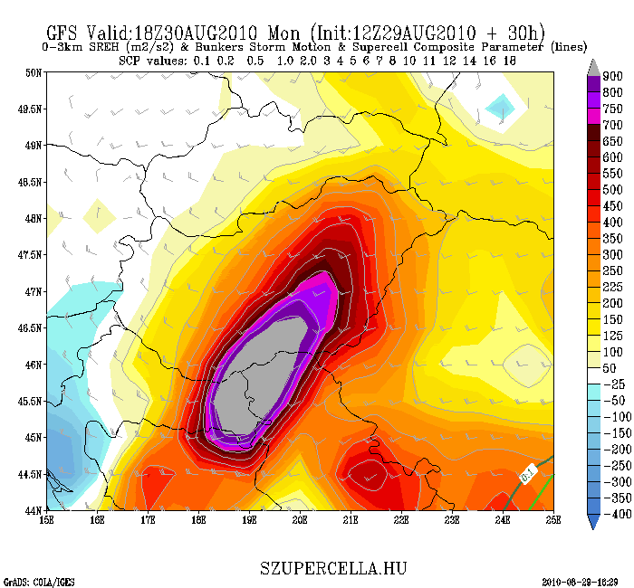
12Z GFS and WRF suggest transient/patchy and weak maxima of MLCAPE, peaking at a few 100 J/kg. This may be tied to quite strong large-scale forcing for ascent, which will likely bring about excessive cloudiness and stratiform rain. It seems that the most coherent CAPE signal exists over the Adriatic Sea south of the cold front. GFS simulates a bullseye of strong precipitation developing over NE Italy, and then expanding northeastwards into the N Balkans, eventually reaching S Poland late in the period. It seems that the dominant precipitation mode with this activity will be non-convective, but with temporary imbedded convective cells. The southern flank of the rain band will move across the N Adriatic Sea per GFS, where CAPE is maximized. This suggests that the best chances for sustained convective activity may exists over the N Adriatic. The shear profiles will be more than adequate for severe evolution with 30 m/s 0-6 km shear, and at least locally 0-1 km shear in excess of 10 m/s. Forecast hodographs vary in shape, but at least temporary and over some parts of the region, favorable curvature is simulated.
Altogether this suggests that isolated line segments and maybe a few mesocyclones may develop in the stratiform precip region, capable of damaging wind gusts and maybe also a brief tornado, given the locally enhanced LLS. However, the main threat will be an augmentation of the stratiform precip by the convection.
Over the Adriatic Sea, chance for more sustained convection seems to exist. If this chance materializes, well-organized multicells and supercells may occur, capable of damaging winds, large hail, and also a few tornadoes. In addition, large amounts of convective precip may occur.
... Romania ...
Farther east over Romania, scattered thunderstorms are likely late Monday night as DCVA associated with the main trough begins affecting the region. Although instability may be weak, and the storms may tend to be elevated ... 20 to 30 m/s DLS will be in place, which should be sufficient for isolated damaging wind gusts and/or large hail.
Zanimljivo


