Tekst od slike koju je Miki stavio
Storm Forecast
Valid: Thu 26 Mar 2015 06:00 to Fri 27 Mar 2015 06:00 UTC
Issued: Wed 25 Mar 2015 22:33
Forecaster: GATZEN
A level 1 was issued for the Ionian Sea area including southern Italy and Sicily, southern Greece, and the southern Adriatic Sea including south-western Turkey mainly for excessive precipitation and to a lesser extend large hail and severe wind gusts.
SYNOPSIS
A deep trough centred across Algeria will lift into the central Mediterranean. At its eastern flank, a strong mid-level jet extends into the east Mediterranean. A weak ridge evolves across western Europe ahead of an new Atlantic short-wave trough moving into central Europe. At lower levels, warm air masses have been advected into eastern Europe, and even warmer African air spreads into the east Mediterranean. Polar air masses are advected into western Europe.
DISCUSSION
Southern Ionian Sea area into Aegean Sea
Ahead of the African trough, a south-westerly flow affects the central and eastern Mediterranean. An embedded sharp short-wave trough travels north-east quickly and is expected across Greece in the evening hours. Strong synoptic forcing is expected with this trough. Ahead of the trough axis, rich low-level moisture has evolved and will increase due to convergence. Furthermore, steep lapse rates are expected given elevated mixed layers across northern Africa spreading north-west. Rather cool low-levels will limit CAPE to around 500 J/kg, though.
Current thinking is that scattered thunderstorms will be present ahead of the trough axis in the morning hours, spreading north and north-east during the period. With 10 m/s 0-3 km and 20 m/s 0-6 km vertical wind shear well-organized multicells and supercells are forecast to produce locally large hail and severe wind gusts. The main threat is expected to be excessive precipitation along the coasts of southern Italy, Greece, and western Turkey due to upslope flow.
Central Italy, Balkans
Near the base of the trough, warm und unstable air masses overlap with rich low-level moisture, and diurnally driven thunderstorms are forecast. Weak vertical wind shear limits severe potential, but large hail and local excessive precipitation is not ruled out with the stronger storms.
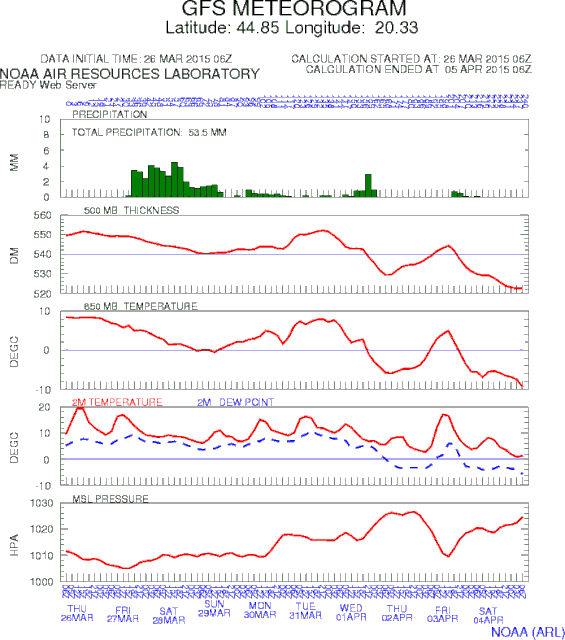
GFS povecao padavine sad na oko 50 litara kise


