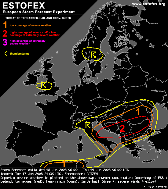
Estofex za sutra:

Central Adriatic to Balkans
Rather steep mid-level lapse rates are indicated by latest ascends over the Adriatic region that will likely
advect eastward into the Balkans with the main flow. Although low-level moisture is limited, CAPE is forecast to
develop. Rather warm mid-level air mass will also favour rather strong CIN initially. During the period, axis of
strong short-wave trough will enter the region. Given QG forcing and mid-level cooling, CIN will likely decrease
and convective initiation becomes likely especially over the mountains, where low-level lift may be strongest.
But numerous outflow-boundaries of overnights convection will also favour convection. Thunderstorms are forecast
to develop from Italy to Romania and Bulgaria during the period. Given strong south-westerly flow in mid-levels,
quite strong vertical wind shear exceeding 20 m/s in the lowest 3 km will result in rapidly developing
mesocyclones and bow echoes. Large or very large hail and severe wind gusts seem to be the main threat, although
tornadoes with more isolated supercells are not ruled out. Convection will likely merge into an MCS ahead of the
main vort-max moving into Romania during the night hours, while severe threat is expected to persist.


